

Quick answer
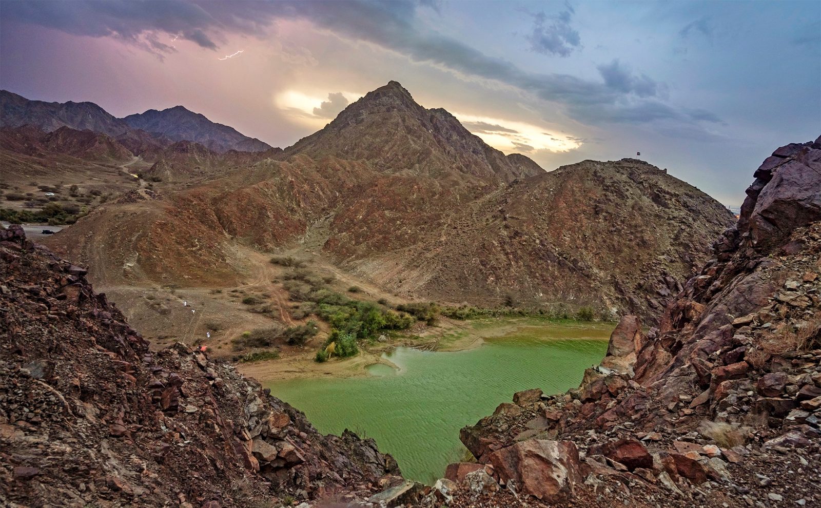
The Wadi Shawka hike route begins at the dam's western parking area and ascends a visible ridgeline to the southeast, reaching the summit cairn in approximately 1.5 to 2 hours. The trail is unmarked but well-worn, following rock cairns and natural contours up a series of steep switchbacks. Elevation gain totals around 400 meters, with the steepest sections concentrated in the final third of the ascent where loose scree requires careful footing.
The trail does not start at the dam wall itself—a common mistake that sends first-time visitors scrambling through unstable talus on the reservoir's eastern shore. Instead, the established wadi shawka hike route departs from a dusty clearing west of the dam structure, where a faint track angles upward through acacia scrub before meeting the base of the ridge. Within ten minutes, the path steepens noticeably, and the Hajar foothills open into view across the wadi floor. Cairns mark most junctions, though wind and foot traffic occasionally scatter them. The first major decision point appears roughly 30 minutes in, where a false trail veers left toward a box canyon. Stay right, following the ridgeline's natural spine. The middle section threads between boulders and low outcrops, and here the Ras Al Khaimah plains stretch westward, offering a visual anchor for orientation. Elevation gain accelerates after the halfway point, and the final approach to the summit involves short scrambles over fractured limestone. No permits are required, and the trail remains accessible year-round, though summer midday temperatures exceed safe hiking thresholds. Navigation is straightforward in clear conditions—the summit cairn is visible from most of the upper ridge—but cloud cover or early starts in dim light demand either a downloaded GPS track or familiarity with the terrain. Mobile signal is intermittent above 300 meters. Descent follows the same route; attempting shortcuts down the eastern or northern slopes leads into cliff bands and loose ground that have required rescue responses in past seasons. The trailhead parking area fills quickly on winter weekends, and vehicles parked along the access road occasionally block emergency and maintenance traffic. The dam itself is a working water infrastructure asset, and swimming or wading in the reservoir is prohibited. Hikers should carry at least two liters of water per person, as no natural sources exist along the route, and the exposed ridge offers no shade past the initial acacia belt.
“The summit cairn is visible from most of the upper ridge, but cloud cover or early starts in dim light demand either a downloaded GPS track or familiarity with the terrain.”
Navigating the Wadi Shawka Hike Route: A Step-by-Step Guide
The Wadi Shawka hike follows a clear progression from the dam parking area through rocky wadi beds to emerald pools, then up mountain ridges for those tackling the full loop. The route takes 2–4 hours depending on whether you turn back at the pools or complete the summit circuit.
Park at the dam trailhead
Drive to Wadi Shawka Dam and park in the gravel lot near the dam wall—arrive early to secure a spot close to the marked trailhead, as the lot fills quickly on weekends.
Follow the wadi bed northwest
Walk along the dry wadi floor, staying on the main channel as it curves northwest between rocky hillsides. The path is unmarked but well-trodden; avoid side gullies and keep the widest channel in view.
Cross the first boulder field
Navigate a section of large boulders approximately 20 minutes in—use your hands for balance and watch for loose rock. This is where most wrong turns happen; stay left and follow the faint painted arrows on larger stones.
Reach the lower rock pools
After 45–60 minutes you'll encounter the first series of natural pools fed by seasonal runoff. These pools are the turnaround point for shorter hikes; many visitors wade or rest here before heading back.
Ascend the ridge trail for the loop
For the full hike, locate the steep trail branching right (east) from the pools—it climbs sharply up scree and loose rock to a ridge saddle. Trekking poles help; the gradient is sustained for 25–30 minutes.
Complete the ridge descent
Follow the ridge loop counter-clockwise, descending via switchbacks that return you to the wadi floor roughly 1 kilometer south of the pools. The descent is loose; take your time and test each foothold before committing your weight.
The Best Time to Visit the Wadi Shawka Hike Route
The optimal time to visit Wadi Shawka is during the cooler months between November and March. Arriving during the best arrival window of 06:00–09:00 is essential to avoid mid-day heat and ensure easier parking at the trailhead.
November–March
Low to moderateMild, 20°C–30°C. Best period for comfortable hiking.
April and October
ModerateWarm, 30°C–35°C. Start early to avoid heat exposure.
May–September
LowVery hot, often exceeding 40°C. High heat risk.
Weekday mornings
Very low—
Ideal for solitude and uncrowded trails.
Verdict: The best time to visit is November through March, arriving at the trailhead between 06:00–09:00.
Getting to the Wadi Shawka Hike Route Entrance
Wadi Shawka is located in the Hajar Mountains of Ras Al Khaimah. The most efficient way to reach the trailhead is by private vehicle, as there is no direct public transportation access to the dam area.
E611 (Emirates Road) or E311 (Sheikh Mohammed Bin Zayed Road) to E55 (Dubai-Hatta Road), then follow signs for Shawka Dam
Direct route via E611 and E55 to Wadi Shawka Dam
Wadi Shawka Hike Route Fees and Costs
Access to the Wadi Shawka hike route is managed as a public recreational area. There are no entrance fees or permit costs associated with visiting the site.
The total cost for an adult to access the hike is 0 AED, as there are no gate fees or required permits.
Opening Hours for the Wadi Shawka Hike Route
The Wadi Shawka hike route and dam area are accessible to the public throughout the entire week.
| Monday | 00:00–23:59 | |
|---|---|---|
| Tuesday | 00:00–23:59 | |
| Wednesday | 00:00–23:59 | |
| Thursday | 00:00–23:59 | |
| Friday | 00:00–23:59 | |
| Saturday | 00:00–23:59 | |
| Sunday | 00:00–23:59 |
Essential Preparation for the Wadi Shawka Hike Route
Wadi Shawka requires no permit or booking, but proper desert hiking preparation ensures a safe and comfortable experience on the exposed trail.
-
Pack 2–3 liters of water per person — Desert heat and exposed sections demand constant hydration to prevent heat exhaustion.
-
Wear closed hiking shoes with ankle support — Rocky terrain and loose gravel require stable footwear to prevent ankle rolls.
-
Apply high-SPF sunscreen and wear a hat — No shade exists on most of the route; sun exposure is intense year-round.
-
Bring a charged phone and portable battery — Cell reception is patchy; a backup power source enables emergency contact if needed.
-
Download offline maps before departure — GPS apps require offline access since mobile data is unreliable in the wadi.
-
Start between 06:00–09:00 — Early arrival avoids mid-day heat and secures parking at the trailhead before crowds arrive.
-
Carry a basic first-aid kit — Minor cuts from rocks and blisters are common on longer hikes; immediate treatment prevents complications.
Check availability
Frequently asked questions about wadi shawka hike route
Everything you need to know about wadi shawka hike route